 NERC Data Catalogue Service
GIS polygon data. (ESRI, MapInfo, others available by request)
Type of resources
Topics
Keywords
Contact for the resource
Provided by
Years
Formats
Representation types
Update frequencies
Scale
-
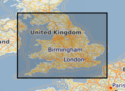
This dataset provides digital spatial information on the location of mineral resources in England at a scale of 1:50 000. The term ‘mineral resources’ has a definition under international standards that includes both an economic and geological dimension. These data are based primarily on mapped geology with limited assessment of economics. Therefore, the term ‘mineral resources’ is used here in a broad sense. The dataset allows users to visualise the extent and distribution of mineral resources and to relate them to other forms of land-use (such as urban areas or designated environmentally sensitive areas) or to other factors (such as transport infrastructure and conservation information). The dataset is derived from a set of commissioned projects to prepare a series of mineral resource maps based on counties or amalgamations of counties. Maps for England were commissioned by the central government department with responsibility for mineral planning at the time (Department of the Environment (DoE), Department of the Environment, Transport and the Regions (DETR), Department for Transport, Local Government and the Regions (DTLR), Office of the Deputy Prime Minister (ODPM), and the Department for Communities and Local Government (DCLG) between 1994 and 2006. Each map produced (with an accompanying report describing the mineral resources depicted on the map) is available to download, as a PDF file from the BGS-hosted website: www.MineralsUK.com. During 2011-2012 revisions were made to areas of the resource linework. These changes were made as a result of new research and release of a new version of DiGMap (v5). This work was on an ad hoc basis but affects all resource layers. In 2020 minor revisions to geometry and attributes were made in in response to minor corrections that were required. The paper maps were not re-released with these data updates. The BGS Mineral Resource data does not determine mineral reserves and therefore does not denote potential areas of extraction. Only onshore, mainland mineral resources are included in the dataset. This dataset has been produced by the collation and interpretation of mineral resource data principally held by the British Geological Survey. The mineral resource data presented are based on the best available information, but are not comprehensive and their quality is variable. The dataset should only be used to show a broad distribution of those mineral resources which may be of current or potential economic interest.
-
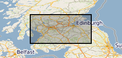
This dataset provides digital spatial information on the location of mineral resources in the central belt of Scotland at a scale of 1:50 000. The term ‘mineral resources’ has a definition under international standards that includes both an economic and geological dimension. These data are based primarily on mapped geology with limited assessment of economics. Therefore, the term ‘mineral resources’ is used here in a broad sense. The dataset allows users to visualise the extent and distribution of mineral resources and to relate them to other forms of land-use (such as urban areas or designated environmentally sensitive areas) or to other factors (such as transport infrastructure and conservation information). The British Geological Survey (BGS) was awarded a grant from the Scottish Government Aggregates Levy Fund in 2007 to provide a comprehensive, relevant and accessible information base to enhance the sustainability of mineral resources for 18 local authorities in the central belt of Scotland. BGS co-funded this project through its Sustainable Mineral Solutions project. This work was completed in March 2008. This dataset comprises the digital GIS files which were produced through this project. In 2020 minor revisions to geometry and attributes were made in in response to minor corrections that were required. The paper maps were not re-released with these data updates. The major elements of minerals information presented are the geological distribution of all mineral resources in the central belt of Scotland. The BGS Mineral Resource data does not determine mineral reserves and therefore does not denote potential areas of extraction. Only onshore, mainland mineral resources are included in the dataset. This dataset has been produced by the collation and interpretation of mineral resource data principally held by the British Geological Survey. The mineral resource data presented are based on the best available information, but are not comprehensive and their quality is variable. The dataset should only be used to show a broad distribution of those mineral resources which may be of current or potential economic interest.
-
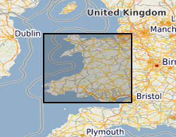
This dataset provides digital spatial information on the location of mineral resources in Wales at a scale of 1:50 000. The term ‘mineral resources’ has a definition under international standards that includes both an economic and geological dimension. These data are based primarily on mapped geology with limited assessment of economics. Therefore, the term ‘mineral resources’ is used here in a broad sense. The dataset allows users to visualise the extent and distribution of mineral resources and to relate them to other forms of land-use (such as urban areas or designated environmentally sensitive areas) or to other factors (such as transport infrastructure and conservation information). The British Geological Survey (BGS) was awarded a grant from the Welsh Assembly Government Aggregates Levy Fund in 2009 to provide a comprehensive, relevant and accessible information base to enhance the sustainability of mineral resources for Wales. BGS co-funded this project through its Sustainable Mineral Solutions project. This work was completed in 2010. This dataset comprises the digital GIS files which were produced through this project. The major elements of minerals information presented on the maps are; the geological distribution of all onshore mineral resources in Wales, the location of mineral extraction sites, the recorded occurrences of metallic minerals, the recorded location of former slate quarries and significant areas of slate waste and the recorded location of historic building stone quarries. In 2020 minor revisions to geometry and attributes were made in in response to minor corrections that were required. The paper maps were not re-released with these data updates. Point data for mineral occurrence and mine site data has not been included in this revision as these data are superseded by other BGS datasets, such as the BGS BritPits database of mines and quarries. The BGS Mineral Resource data does not determine mineral reserves and therefore does not denote potential areas of extraction. Only onshore, mainland mineral resources are included in the dataset. This dataset has been produced by the collation and interpretation of mineral resource data principally held by the British Geological Survey. The mineral resource data presented are based on the best available information, but are not comprehensive and their quality is variable. The dataset should only be used to show a broad distribution of those mineral resources which may be of current or potential economic interest.